|
Take a guided tour beginning with photographs of Drumheller as a coal mining town and ending with Drumheller as a major thriving tourist center. |
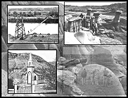
The Drumheller Valley
|
A Video at Youtube.com on the development of Drumheller: |
|
Take a guided tour beginning with photographs of Drumheller as a coal mining town and ending with Drumheller as a major thriving tourist center. |
|
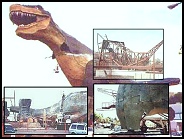
The new GIANT T-Rex: |
|
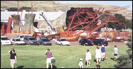
This photo was taken in 2000, when they were building the GIANT T-Rex. The frame for the head is on the right and the legs are on the left. (29 kb)
|
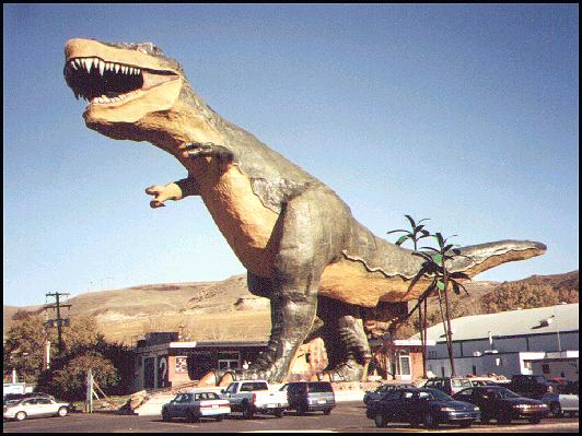
The completed giant T-Rex in the fall of 2000. The visitor can climb the stairs on the inside of this dinosaur, and look out of it's mouth. (48 kb) |
This is a small part of the view from the mouth of the T-Rex. This is where the visitor has a real dinosaur experience. Note the teeth above and the footprints below. (47 kb) |
|
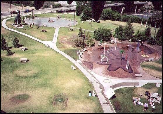
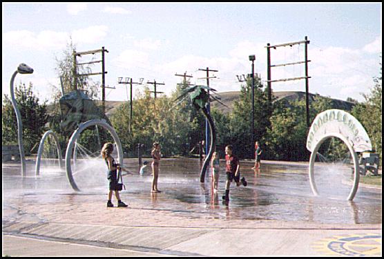
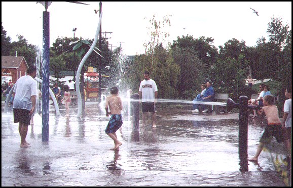
Next to the T-Rex is this water spray park which was built in 2001. (47 kb)
|
The shapes, colors, and sounds make the insides of the giant T-Rex a little like a haunted house. There are also information signs posted. Although the insides aren't really spectacular, it is worth the climb, and it only costs $2.00. (42 kb)
|
Children make good use of the water park. It is extra popular on hot days because this valley has badlands, and therefore has less wind and more heat. (83 kb)
|
|
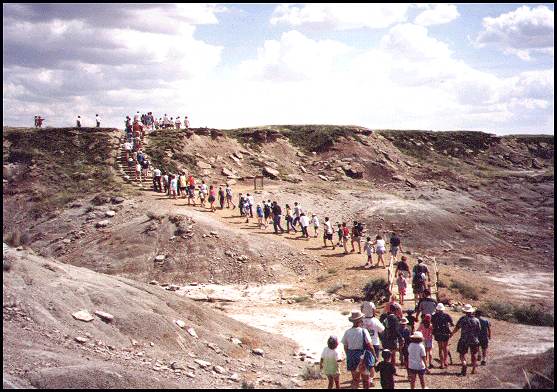
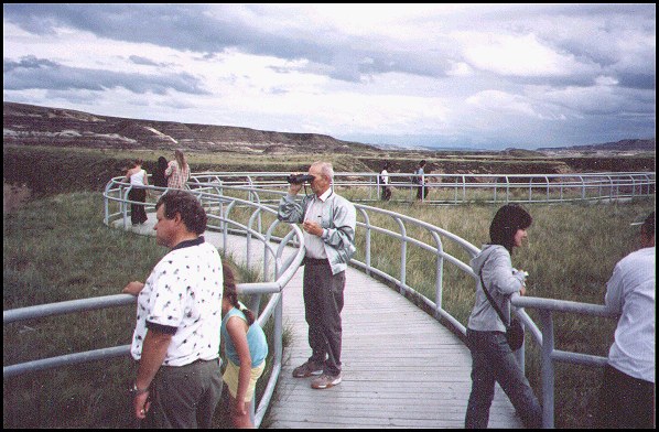
This 1:30 PM tour at the Royal Tyrrell Museum is very popular. They also have a few other short hiking trails for the hiker who wants to experience the badlands. (53 kb) |
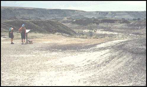
This is part of a self guided interpretive hiking trail which is located north-east of the Museum. (25 Kb) |
These people have climbed the stairs on the hill next to the Royal Tyrrell Museum. From here, they have an interesting view of the badlands and the valley. (83 kb) |
|
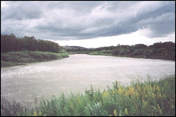
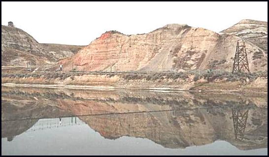
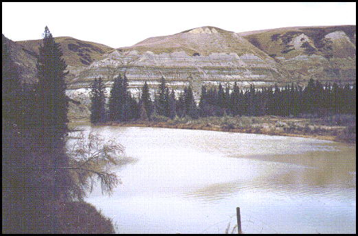
This is the Red Deer River on a cloudy day. (76 kb)
|
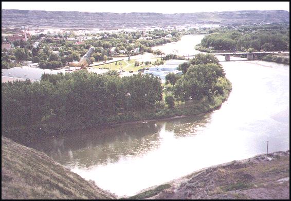
This photo, which was taken from the north side of the Red Deer river, shows the Tyranausaurus Rex and part of the town of Drumheller on the left. (48 kb) |
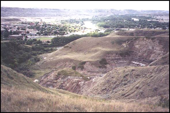
In the distance, you can vaguly see the T-Rex in the bright spot in the middle. The town centre is on the far left. (48 kb)
|
|
Tourists now use the swinging bridge which was built at Rosedale. It used to be used by coal miners who worked in the mine that was on the far side of the Red Deer River. (37 kb) |
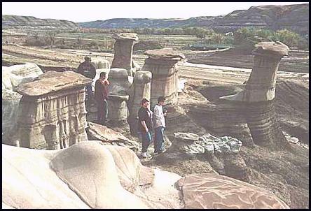
The hoodoos, a unique land formation located about 10 km south-east of Drumheller. (36 kb)
|
A fall view of the Red Deer river, the bridge, and the fountain on the left. (52 kb)
|
|
This amusement park is on the north side of the river, in North Drumheller. The park includes the Homestead Antique Museum, a tea house, miniature golfing, and motorized water tubes. (49 kb) |
A small lake or an attractive large puddle of water? This is located in the Kneehills Creek Valley, at the north end of Horseshoe canyon. (44 kb)
|
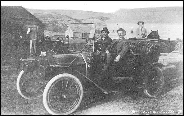 Samuel Drumheller in his Cadilac. |
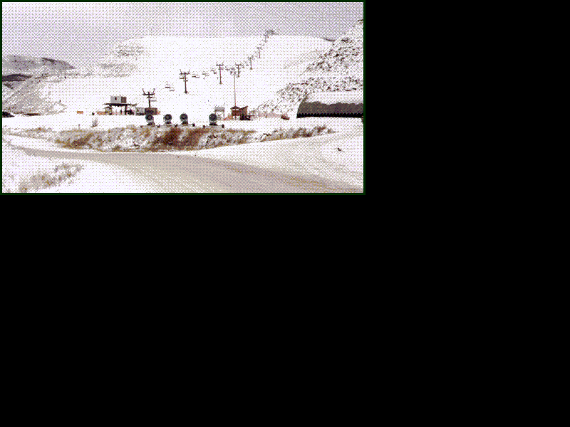 The Drumheller ski hill. It is about the same size as the hill at Canada Olympic Park in Calgary. (41 kb)
|
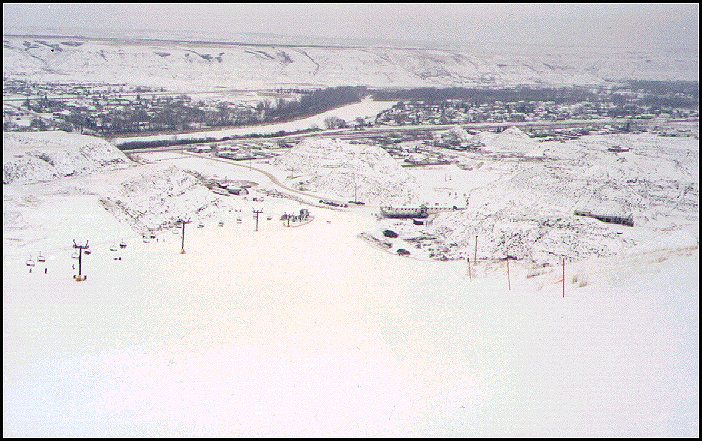 This is the view from the top of the Drumheller ski hill. The ski lodge is at the bottom of the hill, in the centre of this photo. Directly to the right of the lodge, you can see part of the outdoor theatre which is used in the summer to present a Passion Play. The west end of Drumheller is in the distance. (94 kb) |
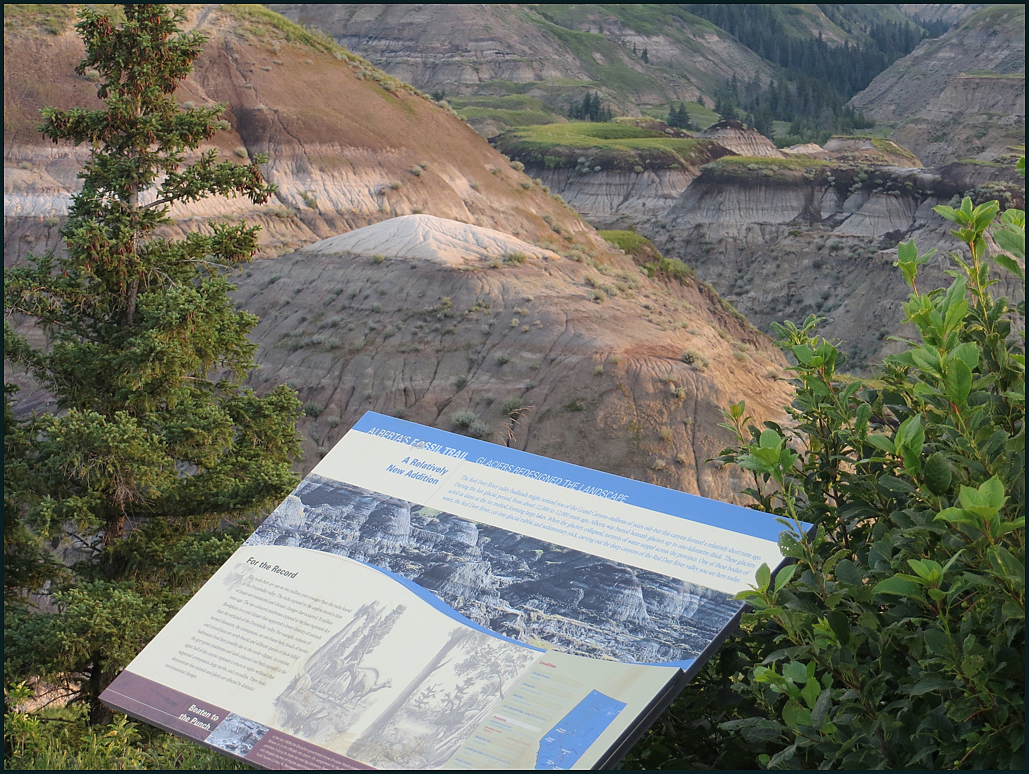
Horseshoe Canyon on a dull
winter day as seen from the south viewpoint. (65 kb) This is what the badlands look like in the winter. For a look at this view of the badlands in the summer, use the Horseshoe Canyon map link below.
|
New photographs taken in 2013:
|
This is the newly paved parking lot at Horseshoe Canyon. |
The early morning at Horseshoe Canyon. |
|
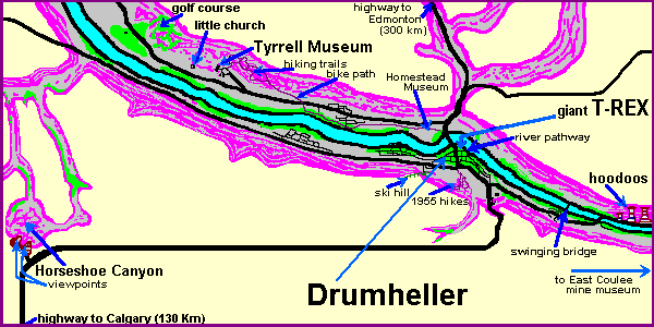
This map of Drumheller and the
dinosaur valley shows the location of some of the attractions. (15 kb)
|
To a larger map and |
|
First posted July 4, 2002. Visitors since September 18, 2003
. |