I would suggest that the East leg of the canyon would be an interesting hike. To find the entrance when you start out from the South Viewpoint, first you have to head north-east to get around the first hill. Then head east and cross the gravel road. This puts you into the beginning of the east canyon.
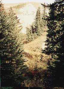
The first 2/5 should be fairly easy, as long as it hasn't rained in the previous few days. I ran into a deer in this area. He ran down the valley and since he had no where else to go, I ran into him again further on.
About 2/5 of the way down, you come to a treed area. At this point, parts of the bottom of the coulee can be wet since it is shaded by the trees.
Soon, you round a corner in the canyon and then run into a short coulee which runs east. In this area you will find the trees to be quite dense. This short coulee is a good place to climb out of the canyon. Make your way north east out of the canyon and to the top where the going is much easier.
Map of Horseshoe Canyon
The map does not show the corner, however you can see the short coulee which goes to the right and will help you to climb up and out.
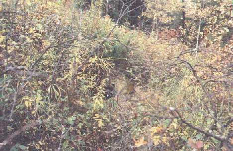
If you decided to stay in the canyon and head north, you will find that both sides of the canyon are steeply sloped. About 5 years ago when I hiked through here I could not find any well worn animal paths. However, as I made my way along a vague path, I did run across a porcupine.
When I hiked through here the dry sticks broke off and stabbed me. My running shoe was ripped and one stick hit my long pants and drew a wee bit of blood underneath. The footing was not good and I suspect that at most, only two people a year go down there. In 1995 it was a real wilderness.
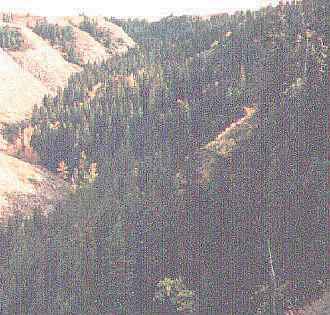
At the top of this photo you can see where the bend in the canyon is. This view looking south also gives you an idea how dense the trees are. If you come this way, heading north along the top, [In top left of photo] you will find it relatively easy to walk.
Once you are on the top, on the prairie, you can then head north along the grass which is between the field and the canyon. It is fairly straight and level so this part should be quite easy. There are one or two places where you will have to climb over a barbed wire fence. When I passed through in May of 2001, there were about 4 cows in this field, so I hiked the empty part.
So, you can make it down to the East Viewpoint where you can get a good view of the valley. As you wonder around on top of the viewpoint, you will get a good view in every direction. Also, you can walk down a slope to the creek in the valley. After spending hours walking through dry areas, it is refreshing to come across a real creek. The creek was clear on one day I was there, but usually it looks a bit dirty or poluted.
My guess is that since the people in the valley have fences erected, they will have cows there somewhere, depending on the time of year and day.
There is a sign on the fence which crosses the road at the east end of the valley which says no trespassing, it is best to not cut across their land in the valley.
At this time, the best route home from the East Viewpoint is probably the way you came.
Please be kind to the cows, deer, and porcupine who live there, and who are not used to hikers or bikers. Don't damage the fences, and carry your garbage out with you. If you behave yourself, there is a greater chance that they won't see the people passing through to be their enemy.
The West Leg of Horseshoe Canyon
I hiked north up the West leg of Horseshoe Canyon with a friend, but after about an hour on a path, we ran into a place where the trail disappeared. The bush on the west side of the canyon and the wet stream bed was not easy to get past, so we turned back.
First posted: 06/20/00.